
Timeline
before 1565
Chinese and Vietnamese trade ceramics and small gold pieces found near Bantigue point to early overseas trade [1]finds, not yet excavated1575
Spanish officials report fine pearls from a fishery near Bantayan [2]documented1580 (11 June)
Augustinian friars found a mission and church on the island [3]documented1582
A Spanish report counts about 1,000 people, large fisheries and millet instead of rice [4]documented1600
Moro raiders burn the church; it is rebuilt the same year [3]documented1628
Raiders from Jolo kill or capture more than 150 islanders; a small fort follows [5]documented1790 (about)
Stone forts are built in Madridejos and Santa Fe [6]date disputed1824
A papal permission lets islanders eat meat on fasting days; it ran out in 1843 [7]reported, original not seen by us1839–1863
The present coral-stone church is built [3]documented1872
Ogtong becomes its own town and is renamed Santa Fe [8]documented1903
The American government merges the island back into one town, Bantayan [9]documented1911 / 1917
Santa Fe, then Madridejos, become separate towns again [10]reported by the municipality1942–1945
Japanese occupation of Cebuevents on Bantayan itself not yet confirmed1981
The whole island is declared a wilderness area; reports from 2019 link this to limits on private land titles [11]current legal position not verified2003
Over 100 poultry farms produce about 1.5 million eggs a day [12]press report2013 (8 Nov)
Super Typhoon Yolanda (Haiyan) hits the island; most houses are damaged or destroyed [13]documented2023
The longer runway of Bantayan Island Airport in Santa Fe opens [14]documented2025 (30 Sep)
A magnitude 6.9 earthquake off Bogo damages the Bantayan church and sinks part of Hagnaya port [15][16]documented
Before the Spanish: fish, pearls and trade
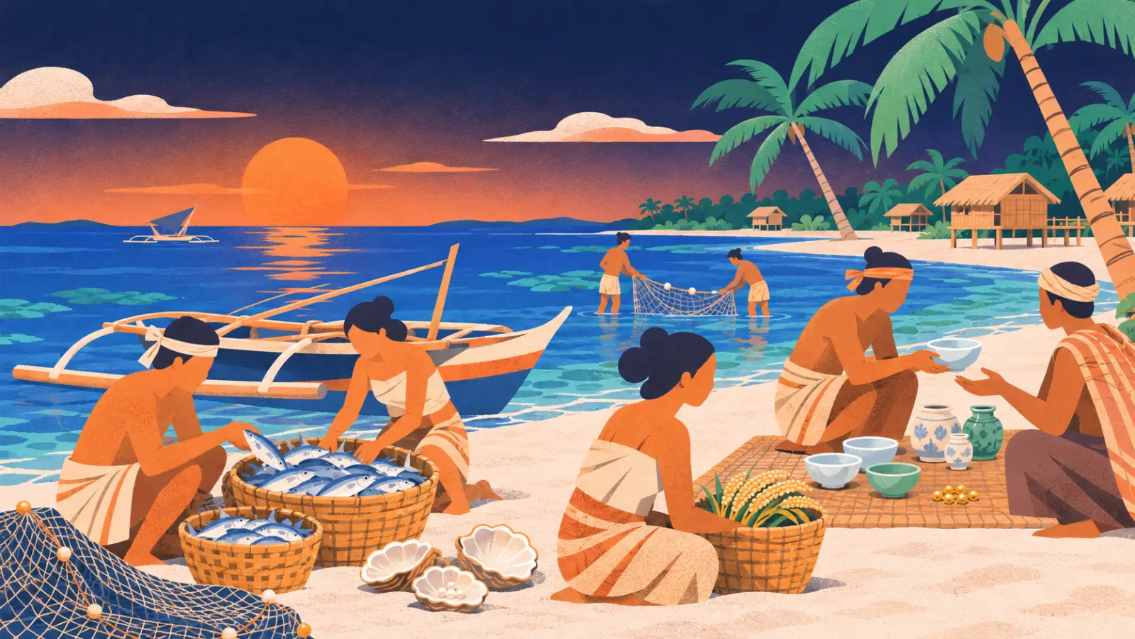
Bantayan sits in the middle of the Visayan Sea, between Cebu, Negros, Panay and Leyte. Its shallow reefs made it rich in fish. The first Spanish reports, from 1575 and 1582, describe large fisheries, a small pearl fishery and about a thousand inhabitants. The soil was too poor for rice, so people grew millet [2][4].
Trade with Asia is older still. Near Bantigue, porcelain, small jars from Vietnam, celadon ware and tiny gold beads wash out of the ground after heavy rain. Archaeologist Jobers Bersales saw these finds in 2007. He warned that looters had dug there since the 1970s and that no proper excavation had been done [1].
The mission and the raids (1580–1800s)
On 11 June 1580, Augustinian friars founded a mission on Bantayan. It was first dedicated to Our Lady of the Assumption and later to Saint Peter the Apostle [3]. In 1603 the parish passed to priests of the Diocese of Cebu [6].
The island lay on the route of raiders from Mindanao and the Sulu islands. They burned the church in 1600 [3]. In 1628 raiders from Jolo killed or carried off more than 150 people. The Augustinian chronicler Juan de Medina wrote in 1630 that the island was “almost depopulated” by these raids. He also called it the “mother of fish” [5]. The parish priest then built a small fort.
Stone watchtowers once stood along the coast: in Suba, Kabac, Tamiao, Kaongkod, Ocoy and on Doong islet. There were also two small forts, the kota of Madridejos and the kota of Santa Fe. Most of the towers are credited to Fr. Doroteo Andrada del Rosario, parish priest in the 1800s [6]. A storm washed away the Baluarte tower in Suba in 1968 [10].
Where does the name come from?
Bantay means “to watch” or “guard” in the Visayan languages. A popular story says lookouts in the towers shouted “Bantayan!” (“keep watch!”) and the name stuck [17]. That is a legend. The name already appears in Spanish documents from 1575 and 1582, before most towers were built [2][4]. Heritage researchers think the island was named for its position as a lookout at the north end of the Tañon Strait [6].
The church of Bantayan
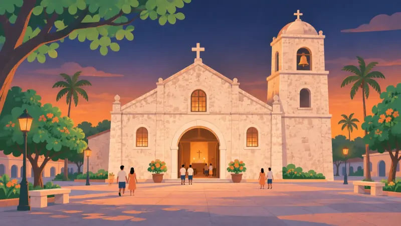
The present church was built from coral stone between 1839 and 1863 [3]. In 1886 its walls were described as about three metres thick [6]. The National Historical Institute placed a historical marker there in 1980 [3]. The parish is known as Saints Peter and Paul. Its official name is the Parish of Saint Peter the Apostle.
The earthquake of 30 September 2025 brought down parts of the church front [15]. Repair plans exist, but we could not confirm that work has started; ask the parish about the current state before you visit.
One island, three towns
The parish dates from 1580; when Bantayan first became a town is not clear. In 1872 the village of Ogtong won its own town status and was renamed Santa Fe [8]. In 1903 the American government cut the number of towns in Cebu. Santa Fe and Madridejos became part of Bantayan again [9]. Santa Fe became a separate town once more in 1911, and Madridejos (old name: Lawis) in 1917 [10]. Madridejos is said to be named after Benito Romero de Madridejos, Bishop of Cebu from 1876 to 1885.
Three towns at a glance
| Bantayan | Santa Fe | Madridejos | |
|---|---|---|---|
| Old name | – | Ogtong | Lawis |
| Own parish since | 1580 | 1881 | 1928 (to be confirmed) |
| Own town since | the start (whole island) | 1872; again 1911 | 1917 (again) |
| Area | 81.7 km² | 28.1 km² | 24.0 km² |
| Barangays | 25 | 10 | 14 |
| Population 2020 | 86,247 | 34,471 | 42,039 |
| Population 2024 | 87,394 | 34,834 | 42,828 |
| Town fiesta | late June (Sts. Peter and Paul) | January (Santo Niño) | December (Immaculate Conception) |
Population: Philippine Statistics Authority [18]. Area figures from PSA 2015 as published; fiesta dates to be confirmed locally.
From pearls to eggs: how people made a living
Fishing has fed the island since the earliest records. In 1937 the island’s main products were pearls, fish and piña cloth. Mother-of-pearl went as far as Europe and the United States [19]. Dried fish, especially danggit, is still the best-known souvenir.
In the second half of the 1900s, poultry farms spread across the island. One farm that began with 500 hens in 1974 had grown to 50,000 birds by 2003. By then the island had more than 100 farms producing about 1.5 million eggs a day [12]. That is why people call Bantayan the egg basket of the Visayas.
Beach tourism grew mainly around Santa Fe, where the ferry from Hagnaya arrives. In 2022, Santa Fe counted 134,770 overnight visitors, fourth in Cebu province [20].
Holy Week and the meat permission
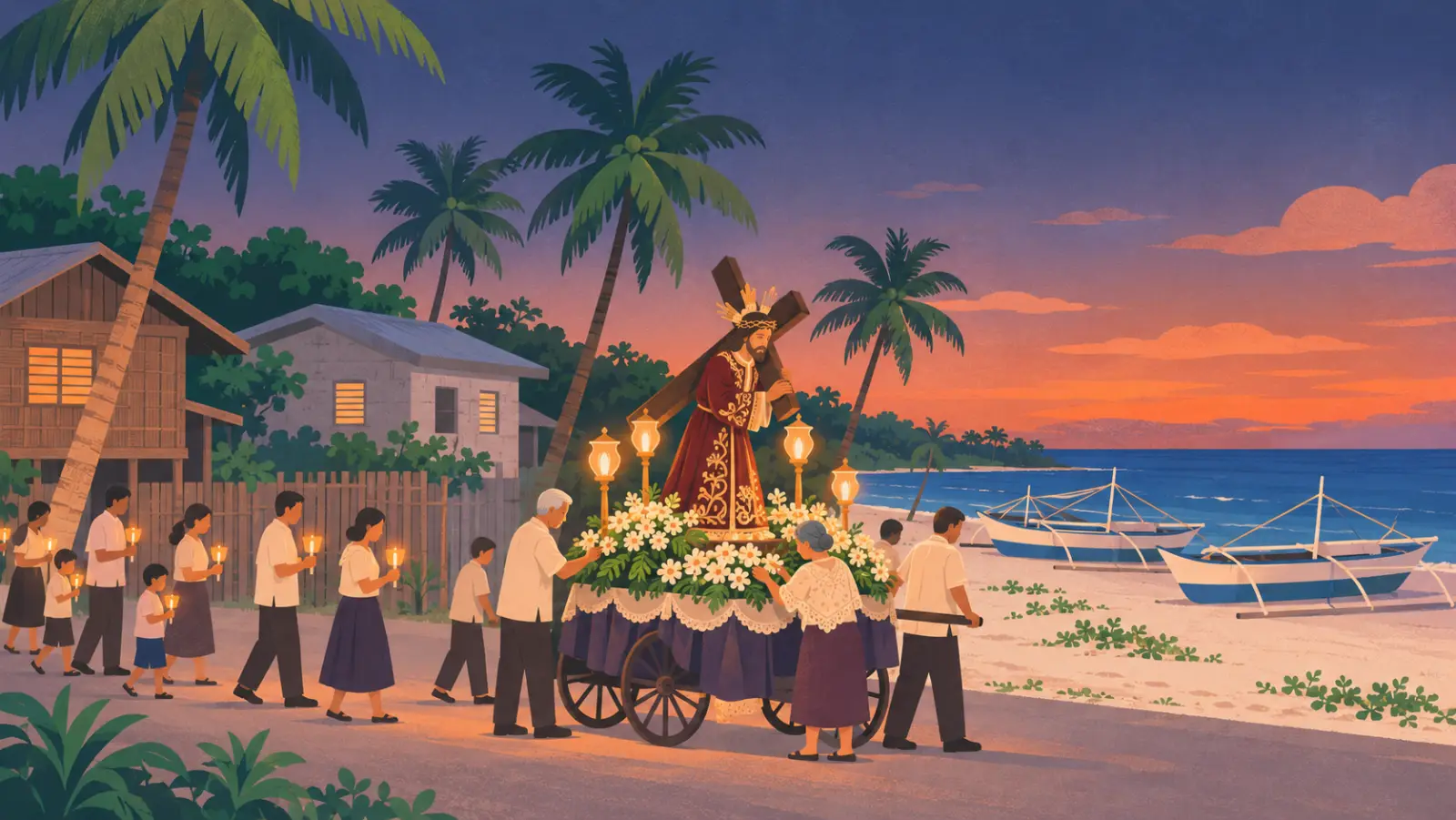
Bantayan’s Holy Week draws thousands of visitors. Its processions carry life-size statues, some of them antique, many prepared by old town families [21].
The island is famous for an old permission to eat meat during Lent. According to secondary accounts, a papal indult dated 27 July 1824 allowed meat, eggs and milk on fasting days. The usual explanation: fishermen did not go out to sea during Holy Week, so there was little fish to eat. The same accounts say the permission ended in 1843; we have not seen the document ourselves. It is no longer valid [7]. Holy Week on Bantayan is a time of prayer, not a fiesta.
The island’s own language
Many islanders speak Bantayanon, a Bisayan language of its own, not a dialect of Cebuano. It has three local forms: Binantayan in Bantayan, Sinantapé in Santa Fe and Linawis in Madridejos. Linguists list it as threatened, with about 71,600 speakers (an Ethnologue estimate) [22].
Typhoons and the 2025 earthquake
The island lies low and flat, so storms hit hard. A typhoon in 1912 killed about 400 people [10]. On 8 November 2013, Super Typhoon Yolanda (Haiyan) crossed the island around 10:40 a.m. [13]. Reports say 80 to 95 percent of houses were damaged or destroyed. The town of Bantayan estimated its losses at 4.3 billion pesos in December 2013; a later report gave 1.5 billion. The egg industry lost most of its roughly one million hens [23][24].
On 30 September 2025 at 9:59 p.m., a magnitude 6.9 earthquake struck off Bogo on the Cebu mainland. It came from a newly found fault under Bogo Bay. The ground at Hagnaya port, where the ferries to Santa Fe leave, sank for good. Reports from October 2025 describe part of the pier flooding at high tide; we have not confirmed the current repair status [16]. Ferries kept running from the undamaged berths.
What we don’t know yet
- What happened on Bantayan during World War II: we have found no reliable record yet.
- When the stone forts in Madridejos and Santa Fe were really built. Dates range from about 1630 to 1792.
- When the Hagnaya–Santa Fe ferry service began.
Do you know more, or have old photos or family records? Tell us – we will check them and credit you.
FAQ
When was Bantayan church founded?
The mission and parish of Bantayan were founded by Augustinian friars on 11 June 1580. The present coral-stone church was built from 1839 to 1863. Source: National Historical Commission of the Philippines registry.
What does “Bantayan” mean?
Bantay means “to watch” or “guard” in Visayan. The name appears in Spanish records from 1575 and 1582. The story that watchmen in the towers shouted “Bantayan!” is a local legend. Sources: Blair & Robertson; Panublion (Ateneo de Manila).
How many towns are on Bantayan Island?
Three: Bantayan (25 barangays), Santa Fe (10) and Madridejos (14). Together they had 162,757 people in the 2020 census. Source: Philippine Statistics Authority.
When did Santa Fe and Madridejos separate from Bantayan?
Santa Fe (then called Ogtong) became a town on 3 October 1872. In 1903 it and Madridejos were merged back into Bantayan. Santa Fe became separate again in 1911, Madridejos in 1917. Sources: Cebuano Studies Center; Act No. 952 of 1903; Municipality of Bantayan.
Can you eat meat on Bantayan during Holy Week?
According to secondary sources, a papal indult from 1824 once allowed meat on fasting days; it ended in 1843 and is no longer valid. Sources: Sugbo.ph (2021), citing the document kept on the island; church officials quoted in Cebu media.
Why is Bantayan called the egg basket of Cebu?
Egg production has long been a major industry on the island. In 2003 more than 100 farms produced about 1.5 million eggs a day. Before Typhoon Yolanda in 2013, the island had about one million laying hens. Sources: The Philippine Star, 2003 and 2013.
How badly did Typhoon Yolanda hit Bantayan Island?
Yolanda crossed the island on 8 November 2013 around 10:40 a.m. Between 80 and 95 percent of houses were damaged or destroyed. In the town of Bantayan alone, 22,687 families were affected. Sources: The Freeman (Philippine Star), 2013–2014.
Did the 2025 Cebu earthquake affect Bantayan?
Yes. The magnitude 6.9 earthquake of 30 September 2025 damaged the facade of the Bantayan church. It also sank part of Hagnaya port, where the ferries to Santa Fe leave. Sources: PHIVOLCS; SunStar Cebu; Interaksyon.
What language do people speak on Bantayan?
Bantayanon, a Bisayan language of its own with about 71,600 speakers (Ethnologue estimate). It has three local forms, one in each town. Many speakers mix in Cebuano and other Visayan languages. Source: Baran (2023), UP Working Papers in Linguistics.
Sources
- Bersales, J. R. “Finding gold in Bantayan”, Cebu Daily News, 13 Sep 2007 – southeastasianarchaeology.com/?p=531
- Blair & Robertson, The Philippine Islands 1493–1898, vol. 3 (documents of 1575–76) – gutenberg.org/ebooks/13616
- National Historical Commission of the Philippines, registry: “Ang Simbahan ng Bantayan” (marker 1980) – philhistoricsites.nhcp.gov.ph
- Miguel de Loarca, Relación de las Yslas Filipinas (1582), in Blair & Robertson vol. 5 – gutenberg.org/ebooks/16501
- Juan de Medina OSA, Historia (1630), in Blair & Robertson vol. 23 – gutenberg.org/ebooks/16451
- Panublion heritage survey, Ateneo de Manila (archived) – web.archive.org (admu.edu.ph/…/panublion/r7_bantayan.html)
- Baluyos, M. “Bantayan fasting exemption has expired”, Sugbo.ph, 2 Apr 2021
- Cebuano Studies Center, University of San Carlos, “Today in the History of Cebu”, 3 October and 10 June entries
- Philippine Commission, Act No. 952, 22 Oct 1903
- Municipality of Bantayan, “Historical Events” and “Milestones” (2019)
- The Freeman, 11 Nov 2019, on Proclamation No. 2151 (1981)
- The Philippine Star, “The egg, not the chicken”, 28 Jul 2003
- PAGASA 11 a.m. update of 8 Nov 2013, as reported by philnews.ph
- The Freeman, “Sta. Fe airport inaugurated”, 9 Mar 2023
- Interaksyon (Philstar), 1 Oct 2025
- PHIVOLCS, “Poster of the 30 September 2025 Magnitude 6.9 Offshore Northern Cebu Earthquake”; SunStar Cebu, 6 and 12 Oct 2025
- Municipality of Bantayan, “Historical Background” (2019)
- Philippine Statistics Authority: censuses 1903–2020; 2024 POPCEN
- Golden Book of Cebu (1937), as quoted in The Freeman, 27 Apr 2020
- Department of Tourism figures for 2022, as reported by Manila Bulletin, 24 Feb 2023
- The Freeman, “Holy Week in Bantayan”, 9 Apr 2017
- Baran, B. S. C. (2023), “Amini ang Linawis”, UP Working Papers in Linguistics 2(2)
- The Freeman, 11 Dec 2013 and 2 May 2014
- The Philippine Star, 9 Dec 2013
Chart
Population over time
Show the numbers
| Census | People |
|---|---|
| 1903 | 20,476 |
| 1918 | 24,271 |
| 1939 | 35,288 |
| 1948 | 50,209 |
| 1960 | 56,851 |
| 1970 | 69,926 |
| 1975 | 78,189 |
| 1980 | 82,363 |
| 1990 | 106,584 |
| 1995 | 110,486 |
| 2000 | 120,101 |
| 2007 | 129,154 |
| 2010 | 136,960 |
| 2015 | 144,116 |
| 2020 | 162,757 |
| 2024 | 165,056 |
Source: Philippine Statistics Authority census.
Find it on the map
- Ogtong Cave ResortDirectionsReviews & photos
- Sts. Peter and Paul Parish ChurchDirectionsReviews & photos
- Hagnaya Port, San Remigio (ferry to Santa Fe)DirectionsReviews & photos
Opens Google Maps. Reviews and ratings are Google's, not ours. The map loads only when you tap “Map & rating”.
Keep exploring.
Places · Bantayan
Sts. Peter and Paul Parish Church, Bantayan
Bantayan town's coral-stone church (built 1839–1863) of a parish founded in 1580, one of the oldest in the Philippines. Visitor notes and 2025 quake status.

Places · Santa Fe
Ogtong Cave
Ogtong Cave is a cave with a spring-fed pool inside a private resort in Santa Fe. Day-use fee, hours and its status after the 2025 earthquake.

Weather · Tides · Typhoons
Weather, tides and typhoons on Bantayan
Current weather in Santa Fe, high tide at Hagnaya port (loading may pause), and where to find official typhoon and sea travel warnings.
 Local guide check pending
